Breathe Cam

Credit: U.S. Steel Clairton Coke Works

Breathe Cam Highlight Videos

Play Video
Edgar Thomson Brown Plume – June 17, 2020
From Breathe Cam
Share
Play Video
Metalico Scrap Metal Fire, Neville Island – April 14, 2021
From Breathe Cam
Share
Play Video
Clairton Coke Works Fire – Dec 24, 2019
From Breathe Cam
Share

How To Use Breathe Cam

What is the Breathe Cam?

Breathe Cam is a project of the CREATE Lab at Carnegie Mellon University, in collaboration with the Breathe Project of The Heinz Endowments.

Images are captured using an off-the-shelf, Arecont 40 megapixel 180° panoramic IP camera. This model houses four high-resolution cameras inside a glass dome and is designed for outdoor mounting. The base of the camera housing contains a built-in heater/blower, which helps regulate the air temperature throughout the year. Data is transferred via an Internet connection and the entire system can be powered with a single 120v power outlet.

At the back end, Breathe Cam is powered by the CREATE Lab’s Time Machine software, which accumulates individual images taken over time and stitches them together to create panoramic video timelapses. The true power of this software lies in its ability to provide zoomable, terapixel-scale animations that allow you to delve into intricate details and explore how the panorama changes over space and time.

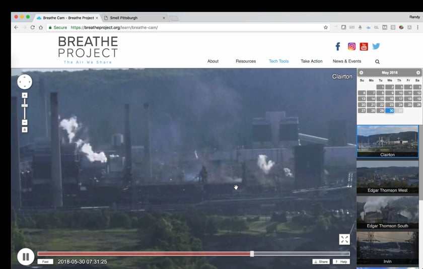
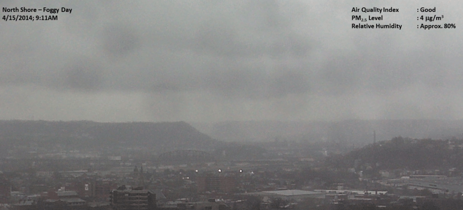
To help you interpret Breathe Cam images, air quality and meteorological data from the Allegheny County Health Department are displayed below the panorama. You can see how the following data gathered at nearby ACHD monitoring stations change over time:

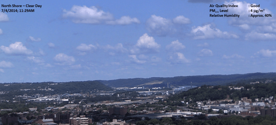
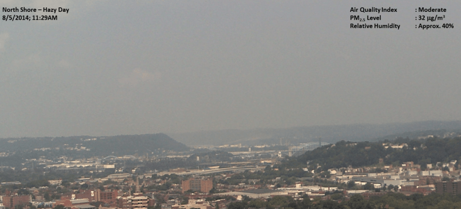
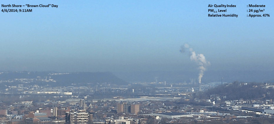
Fine particles (PM2.5)
Respirable Suspended (RS) or Coarse particles (PM10)
Sulfur dioxide (in ppb)
Temperature (in Fahrenheit)
Percentage of relative humidity
Wind speed and direction

By clicking on any of the numbers in the ACHD data table, you can activate a graphical display of this information, showing how these metrics vary over time with the panoramic video timelapse.

The Change-Detect tool enables you to monitor specific landmarks or types of activities within the Breathe Cam panoramas. Simply move and size the green rectangle to cover the area of interest, and the software will graph changes detected in that region. You can then follow the data pattern to see how notable variations in the graph correspond to real-world changes in the panoramic video timelapse. For example, you could track train activity, emissions from a specific smoke stack, traffic levels, etc. Once a detection area is selected, you can click a button to create animated gifs that highlight particularly interesting events related to the type of change you monitored.

Data Disclaimer

Edit Content

Look carefully. Does the picture really seem clear?

On clear days, features on the horizon look crisp and pollution and relative humidity levels are low. If today’s images are not as clear as in this photo, then there may be haze or fog obscuring the view.

Breathe Cam screenshot of the seemingly "clear" sky with scattered clouds
Edit Content

Is it a hazy day?

Haze is relatively uniform across the horizon, but tends to diminish slightly at higher elevations. Look at pollution levels. Also, note the relative humidity. Haze often occurs with medium or high levels of fine particles or ozone. Relative humidity also tends to be medium to high.

Breathe Cam screenshot of severe gray haze casting over the city horizon
Edit Content

Is it a “brown cloud” day?

A brown cloud appears to envelop the scene, but quickly thins out at higher elevations. Brown clouds tend to occur when a layer of warm air higher in the atmosphere traps pollutants at the surface. Particle levels are usually high, and relative humidity may vary.

Breathe Cam screenshot of brown foggy clouds over the city horizon and smoke pluming the sky
Edit Content

Is it a foggy day?

Look at the relative humidity and precipitation levels. If the relative humidity nears 100 percent and there has been precipitation in the past 24 hours, then you are probably looking at fog. Fog tends to be gray, while haze is generally white. It is most common in the fall and spring and doesn’t thin out at the top of the image.

Breathe Cam screenshot of thick dark gray fog engulfing the city sky

Raw visual data on this website are collected and reported on a real-time and automated basis by the Breathe Cam system. Although measures are in place to ensure the integrity of the captured images, the data have not gone through the rigorous quality control procedures that government agencies usually perform before releasing such data for regulatory and scientific purposes.

Note: That there may be dates when our cameras are down due to inclement weather conditions or technical issues. On such occasions there will be interruptions to the time-lapse panorama at certain time periods. Also note that during the night images appear black and white because cameras switch to IR mode, which allows you to see greater detail including smoke emissions, and cloud and fog movement.

Credits

Breathe Cam was developed by the CREATE Lab at Carnegie Mellon University with support from:
The Heinz Endowments logo
The amazing views of Pittsburgh’s skyline could not have been captured without wonderful partnerships with:
Meteorological and pollutant data is furnished by: